


England's Topographer or a New and Complete History of the County of Kent. From the Earliest Records to the Present Time. Including every Modern Improvement. Embellished with a Series of Views from Original Drawings by Geo. Shepherd, H. Gastineau, etc., with Historical, Topographical, Critical and Biographical Delineations.
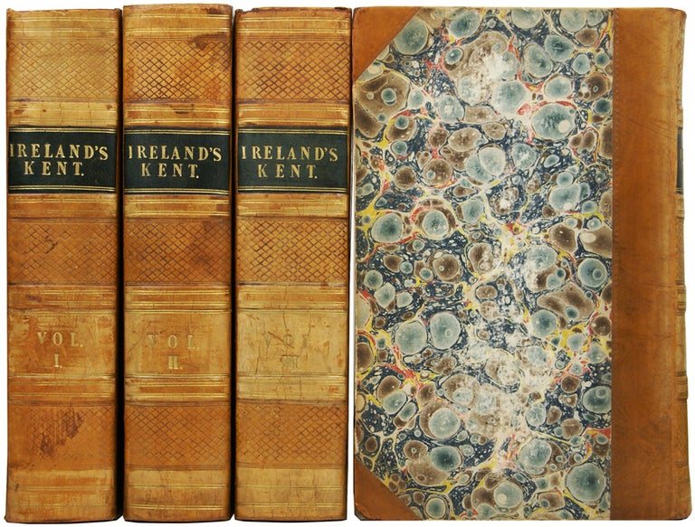
London: Geo. Virtue, 1828-1830. [Kent] FIRST EDITION, ILLUSTRATED. Four volumes, octavo (22 x 15 x 21cm), pp.[4]; ii; 712; xix of index; [1]; pp.[2]; 713; [1]; xv of index; [1]; pp.[4]; 698; xviii of index; [4]; pp.[2]; 780; xiii of index; [1]; [8 of errata]; 19 list of subscribers; [1]. Illustrated by 124 engraved plates, including the title page, with a folding map of Kent in volume one. Bound without the instructions to the binder. Contemporary half calf over marbled boards, gilt titles to black morocco squares to spines, diced pattern to spines. Marbled edges and endpapers. Some toning and spotting to plates, and neighbouring pages, remains of a small label to first blank of volume I, neat old tape reinforcement to map folds. Upper joint of volume I starting, same of volume III split halfway but still securely attached. Binding slightly rubbed, chipped to heads of the spines. A presentable set in a nicely aged older binding. Very good. Item #49618
Price: £295.00
Standard worldwide shipping is free for all orders over £200. UK standard postage is free for all orders. For expedited delivery, please contact us directly. See our full terms.
See all items in
Kent & Sussex,
History & Biography
See all items by William Henry IRELAND